Utah Rare Plant Guide logo
Introduction Acknowledgements Rare plants Other plants Glossary What's new Wishlist Links
Introduction

UTAH RARE PLANT GUIDE
(a work in process)

Purpose
 
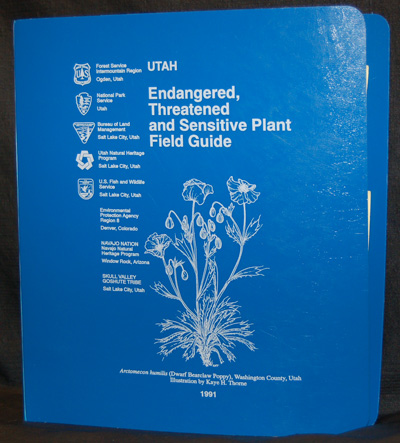
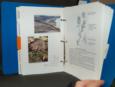
The initial purpose of the Utah Rare Plant Guide (URPG) was to convert and update the 1991 publication entitled Utah Endangered, Threatened and Sensitive Plant Field Guide to an on-line, electronic version to be made available to the public.
 
Utah Endangered, Threatened and Sensitive Plant Field Guide (1991) Utah Endangered, Threatened and Sensitive Plant Field Guide (1991)
The first on-line version was made available to the public in 2003.
 
By moving the guide to a digital, on-line format, distribution to a much wider audience than with a printed guide becomes possible. In addition, updates can then be made in a much more inexpensive and timely way.
 
In addition to being able to view Utah rare plant information, rare plant pages have been prepared in a way to also allow for printing at higher resolution.
 
There is a continuing need to study rare plant species in Utah to better understand their habitat requirements and develop management prescriptions that will assist in the conservation and recovery of these species, and help all people learn and appreciate their value.

Viewing requirements
 
You must have Javascript enabled in your browser (it is likely that it is).
 
Netscape 4/IE 4 or higher or equivalent should be used to view these pages. Internet Explorer or Opera are recommended.
 
The images have not been designed/limited to a certain resolution, however we recommend a resolution of at least 1024 x 768.
 
To view/print PDF's (optional), you will need to have a previously installed version of one of the available the free PDF readers.

How to use (navigating the Rare plants page)
 
To view taxon information on the Rare plants page, simply click on the link corresponding to the species or variety you wish to view.
 
If you want to print any of the information, be sure to (a) click on the PDF link and (b) use the Printer icon within your PDF reader (not your browser's print option). Since the PDF contains the images at a higher resolution and is suitable for printing, it will always take longer for that to download.
 
When viewing the initial preview images, if you are using a non-Netscape browser, you will see the options:
              Both 1 2 PDF  
             
"Both" (meaning the drawing/description page and photograph/map page will be displayed side by side) is the initial default. Click on 1 to view just the first page. Click on 2 to view just the second page. Click on Both to go back to side by side mode.
 
When selecting either "1" or "2" you can make the displayed image larger or smaller thru use of the buttons that will appear. That same ability also exists when loading the PDF but may in some cases provides a more convenient option especially in the event that something is hard to see.
 
A species with supplemental information associated with it, will contain a link entitled:
             More
             
Click on More to see the supplemental information (PDF format).
 
A separate window will appear for each taxon that is selected (or will appear in a separate tabbed window depending on the browser being used). If you click on a rare plant link and nothing happens, chances are that it is already open in a window. Check your taskbar or cycle through your open windows (ALT-TAB for Windows users) to locate it and then set the focus back to that window simply by clicking on it.
 
If you experience any problems or have any questions/comments, please e-mail Tony Frates at unps@unps.org.

 Taxonomy, descriptions and scope
 
The 1991 Utah Endangered, Threatened, and Sensitive Plant Field Guide on which this guide was initially based did not include a specific references section but indicated that it primarily followed Welsh (1987) (and also referred to readers to the Intermountain Flora series volumes that were available at that time, Vols. 1, 3B, 4 and 6, for further technical information). See the primary references section of this guide for citation information.
 
This guide does not follow any one flora or resource for the identification or description of any given taxa (nor necessarily does it follow the treatment of a genus from any one reference or resource). One reason is that Utah has a number of floristic resources to rely on, and no single one of those resources can necessarily be complete and/or current. The first volume of the invaluable Intermountain Flora series (the main coverage area of which is essentially all of Utah and Nevada) was published in 1972 and the final volume, some 40 years later, in 2012. The Flora of North America (FNA) is another valuable resource but is not complete nor necessarily current (the Asteraceae for example are not being updated and not all families have yet been covered). Since the 1991 rare plant field guide, Dr. Stanley Welsh et al have published three revised editions (1993, 2003 and 2008) all focused on the vascular flora of Utah. This also invaluable resource however has primarily been based on specimens deposited at the BYU herbarium (particularly in the later editions) and is missing information from other Utah herbaria. New taxa continue to be discovered and named and may be at odds with prior some treatments which can then have a rippling effect. In this guide, we also have the luxury of being able to incorporate data from reliable observations that is not recorded at any herbaria nor included in published papers.
 
In terms of taxonomy in general, the most prudent approach seems to require consideration of all of the major floristic treatments that have included the state as well as published papers in peer reviewed publications. At the same time and in order to be at least somewhat conservative, it is not the intent of this guide to necessarily adopt the very latest change that has not yet been accepted by the local botanical community at large except when no other option is logical. It is also always the intent to use the best available information and not choose the treatment that recognizes an entity at a higher level than another (balanced with the idea that when all things are equal, the benefit of the doubt should go to the higher level treatment).
 
The impact of a significant body of genetic work cannot be ignored and must be considered as a characteristic that must "make sense" within a larger context, but should also not be the sole consideration.
 
Family names represent a newer problem in light of the work of the Angiosperm Phylogeny Group where various prior families, for example, have been combined with others. For now we continue to follow the more traditional approaches as used in the Intermountain Flora series and in FNA but may start to at least cross-reference the APG treatment. So if adopted, those changes would include placing Castilleja in Orobanchaceae, Penstemon in Plantaginaceae, moving the Asclepiadaceae to within Apocynaceae, moving the Hydrophyllaceae to within Borginaceae, moving the Fumariaceae into the Papaveraceae, and so forth. Making these changes currently could cause more confusion than provide clarity.
 
As with the 1991 guide, this guide focuses on vascular plants; this is not because non-vascular plant species do not deserve equal attention and rare non-vascular plant species are known for the state and hopefully can at some point be included (one significant problem being that even less is known about non-vascular plants, making an assessment of their rarity rather difficult).

Maps
 
Out of a concern for revealing too much information, the versions of the on-line guide from 2003 through mid-2010 only provided maps with a single dot for each county placed more or less in the middle of that county, simply to give the user an exceptionally basic idea about the distribution of the taxon within the state. This was unlike the 1991 "blue book" approach which, using similarly small-sized Utah maps provided dots based on actual distributions and included multiple dots within counties as appropriate to show major or primary occurrences.
 
Starting in roughly mid-2010 and while it remains beyond the scope and intent of this guide to provide detailed locality information, some maps started to be changed to show dots closer to actual occurrences; however, because of the small size of the maps this newer approach will still never include more than one dot in a given county. So a single dot should not be interpreted as anything more than the general area of primary distribution of a taxon in a given county (and the taxon could for example occur elsewhere in the county far removed from the single dot). In this way we hope to provide the user with a little more of an idea of a plant's distribution. The user will also still encounter older maps with a dot simply in the middle of the county as well.
 
In addition to a dot to indicate county level only distribution, the use of an asterisk (*) started to be used in mid-2010 to indicate an historic county-level distribution that has not been re-located in say the last 75 years or which is known to have been since eradicated from the county. The use of a question mark ("?") in a county may coincide with the text where a question mark following county distribution may be given in situation where the distribution has not been verified there or where a question exists concerning the specimen or report of its existence in that county.

Conventions used for elevation and measurements and related comments
 
Elevation ranges are provided normally where the taxon is known to occur in Utah and if a distribution occurs outside of Utah, the range provided may or may not encompass that non-Utah range. Unlike floristic treatments that tend to rely solely or primarily on herbarium specimens, data based on reliable observations is included when available in elevational ranges, and since herbarium specimens only provide a limited glimpse of the true elevational ranges of most taxa.
 
Similar to the 1991 printed guide, "feet" is the standard unit of measurement used throughout for elevations. For all plant measurements, the metric system is used.
 
Where providing a lower and upper level range might tend to distort the normal "primary" range where a taxon might be found, parentheses are used around the lower and upper limits. So (5,500) 6,000-7,000 (8,000) feet elevation means that the taxon primarily occurs at an elevation of 6,000 to 7,000 feet but is also known to occur as low as 5,500 feet and as high as 8,000 feet.
 
The same approach is used with respect to plant measurements with respect to sizes that tend to fall above or below the normal or typical size.
 
Utah has a widely diverse geography which has played a significant role in the high level of biodiversity here. With a reported mean elevation height of some 6,100 ft. (1859 meters), Utah is one of three states with the highest elevations in the United States. The elevational spread is roughly 11,368 feet with a low of 2,160 ft (658 m in Beaver Dam Wash in the southwest corner of the state - see note) to a high of 13,528 ft. (or 4,123 m at King's Peak in the Uinta Mtns; sometimes reported as 13,538 ft).
 
NOTE: Utah's lowest elevation is sometimes inaccurately reported as 2,000 feet. While areas south of and adjoining Utah's Washington Co. in Arizona's Mohave Co. actually mostly rise and tend to be higher than here, in the relatively narrow width only of the Beaver Dam Wash the elevation does slowly drop as it proceeds through northwestern Arizona but does not reach 2,000 feet until some 3.5 air miles south of the Utah-Arizona border. Via some measurement systems including Google Earth imagery, the lowest Utah elevation appears to be in the 2,175 to 2,179 foot range. However measurements taken by informal investigations have reported GPS-based elevations (with an unknown accuracy rate) in the range of 2,154 ft. to 2,165 ft (right at the junction of the Beaver Dam Wash and the UT-AZ border). Based on these reports and map contours, an approximate revised low is the 2,160 feet indicated with perhaps a 10 to 15 foot margin of error. There is actually however very little acreage in Utah even in the southwest corner of the state under 2,200 ft and the lowest reported ranges for plant collections usually aren't much lower than 2,400 to 2,500 ft. (i.e. roughly 730 to 760 meters) and then only in a limited area in Washington County where these lowest Utah elevations occur.

How to link to individual taxa on the Rare Plants page:
 
To link directly to one of the species or varieties on the Rare plants page, use either the link tag format:
https://www.utahrareplants.org/rpg_species.html?Genus_species target="_blank"
or
https://www.utahrareplants.org/rpg_species.html?Genus_species_var_variety target="_blank"
 
Examples:
https://www.utahrareplants.org/rpg_species.html?Arctomecon_humilis
https://www.utahrareplants.org/rpg_species.html?Draba_maguirei_var_stonei
https://www.utahrareplants.org/rpg_species.html?Pediomelum_pariense
 
To simply link to the guide without linking to a specific species or variety:
https://www.utahrareplants.org/rpg.html
or
https:/www.utahrareplants.org/rpg_species.html
How to cite this resource (CSE style):
 
Utah Native Plant Society. 2003-2022 [cited {your access date}]. Utah rare plant guide. [Internet]. Frates AJ, editor/coordinator. Salt Lake City, UT: Utah Native Plant Society. Available from: https://www.utahrareplants.org.

Copyright/permissions
 
Copyright 2003-2025 Utah Native Plant Society
 
Photographs/slides/diagrams remain the property of the individual submitters in most cases (excluding materials submitted by US government agencies or employees of those agencies submitting materials that originated as a result of their official government related duties) and may not be used without permission.
 
Portions of this guide were based on the 1991 publication entitled Utah Endangered, Threatened and Sensitive Plant Field Guide which substantially was a US government publication.
 
To request permission to use anything contained in this guide, please send an e-mail to unps@unps.org. Permission is not required to link to the guide (please do not try to link to the guide via a frame; it is also not permissible to link to the guide from anywhere other than via https:/www.utahrareplants.org).


Copyright 2003-2025 Utah Native Plant Society